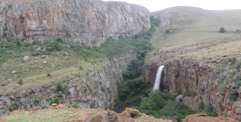
The picture shows why we had to do this hike, but the waterfall is not the only attraction.
 There were only five of us, Lydia, Judith, Frans, Jenny and me. The first good thing that happened was that we got upgraded from the hikers accommodation to the chalets, that is the third time it happened to us this year. It was very welcome, although the hot water system was not working very well. It had a gas geyser with very finicky controls and maintaining a constant temperature was not possible. It has been brought to the attention of management. Well, so we arrived on Friday afternoon and made ourselves comfortable.
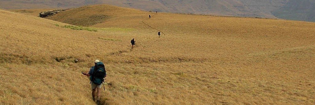
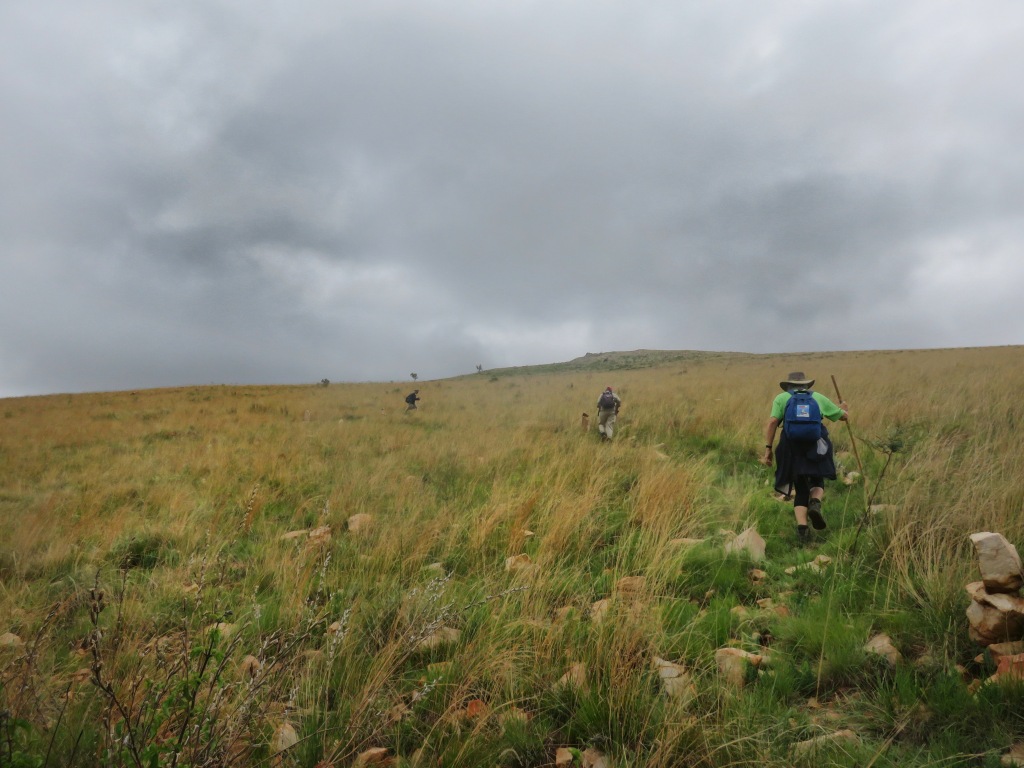
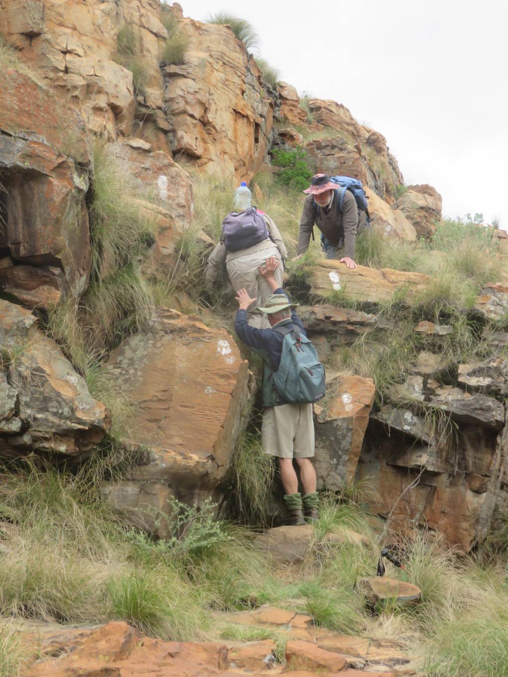
 In the morning we were off to do the green route, that is the route marked in green on the map and on the path. It took us over grass land, up the mountains and around to the Langkloof river. An interesting find en route was a place were diggings have been taking place. I identified a block of concrete as being the foundation for a crusher and some other foundations to be for a conveyor feeding the crusher. Gert informed us later that this was a gold digging. This was a bit of a surprise to me, the nearest gold diggings to this is at Lydenburg and in a completely different geological strata. This needs to be investigated.
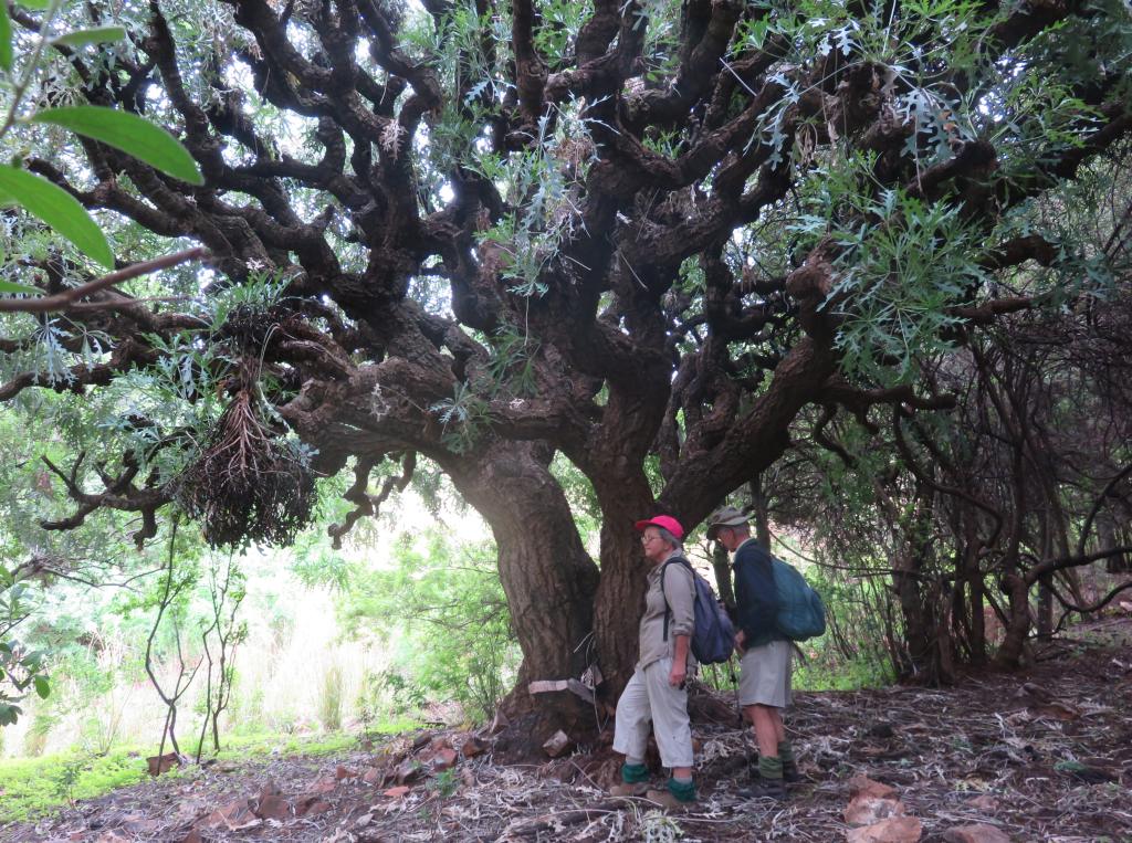
 Also along this route were some huge Cabbage trees, Cussonia paniculata. It had a label attached, that's how I know.
 Going over a few mountains we eventually came to the valley of the Langkloof river, and because we wanted to have lunch on the banks of the river we diverted from the green route to get down. Whilst there we noticed some white foot markers, most likely indicating a previous route. Since they, the foot prints, followed the river we stayed on them, they were leading us in the right direction.
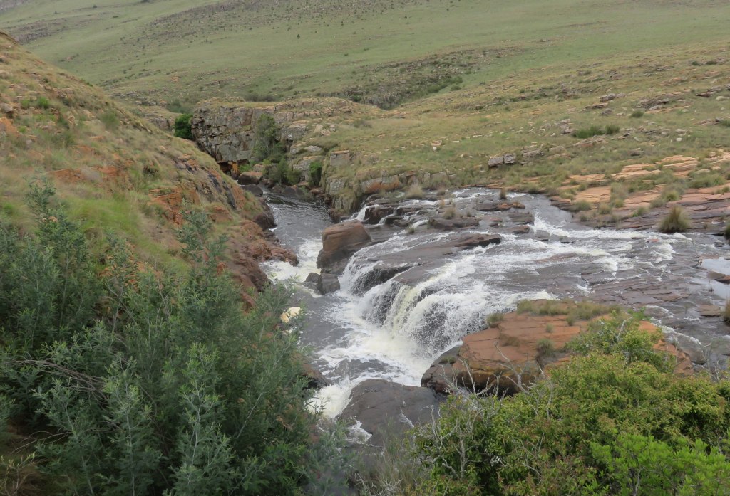
>The river was flowing strongly after the recent rain which added to the excitement of following the course of the river. After some minor water falls and some rapids we got to the real rapids, at a place where there used to be a hiking hut. The ruin is still standing.
 From here we were hoping to pick up the green route again, no, it was still the white foot prints we followed which brought us down to the top of the water fall. What a beautifully setting. The water in free fall down into the gorge formed by geological faulting. The run of the fault lines can clearly be seen.
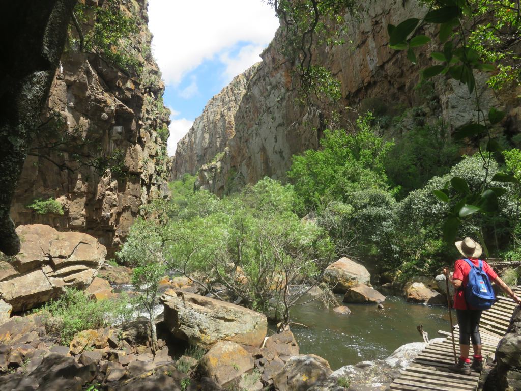
The gorge now was really deep, we stayed above it, there was no way down into it. That had to wait for the next day.
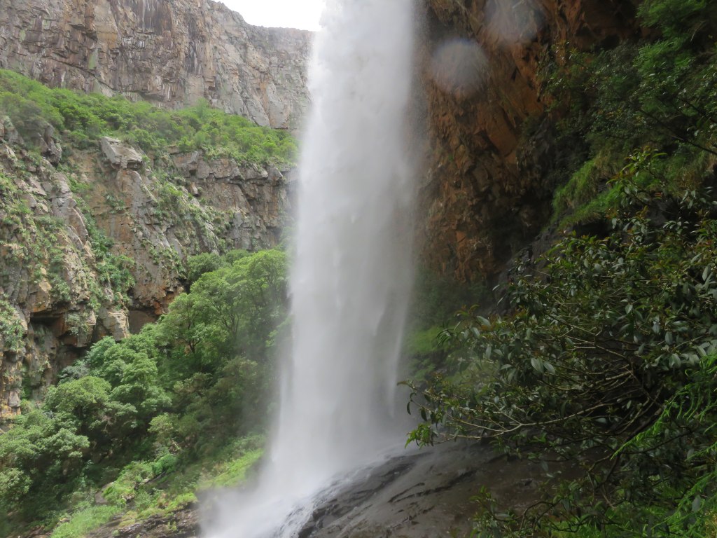 On Sunday we did the yellow route, which follows the river into the gorge up to the bottom of the water fall and out again following the same path. This was very adventurous, it followed the river at the bottom of the gorge, surrounded by high rock walls on both sides. That way we made contact with the big water fall and got close enough to even get wet. This yellow route is a great hike.
Certainly a hike I would like to repeat, next time, weather permitting, with a few swimming stops.