I like to be a bit more specific about the where abouts of this hike, but this is difficult since there is no large town nearby. We came in from Ermelo and Amsterdam through the border post of Sandlane, the SAPPI papermill in Bhunya is the last point of prominence that I could mention. From there its about 50km. And if you really want to know the coordinates of the starting point are: 26.6602°S 31.1744°E. Now you can look it up on Google Earth.
Who went? Not many: Tania, Allen, me and the kids. Eleni had to stay at home to look after her mom.
 We left Wednesday after school and stopped over in Ermelo in the Backpackers. Pleasant place and very cheap. Early in the morning we were up to cross the border, which went without standing in queues and only took a few minutes. The last few kilometers were all on roads that were not shown on any of our maps, Google Earth came to the assistance allowing us to program the GPS such that we found the place without a hitch.
But James wasn't there, he had been seen driving off in a taxi. But not to worry we were sent over to Mrs Evans. She is the local farmers lady who used to do the organisation of the hike before the 'community' decided to take it over. She quickly got us sorted out allocating her bed & breakfast as a starting point. James also arrived to collect our money and to give us Nkosana to take us to a place from where we would be able to find our own way. He took us to the school and than pointed down the valley and said 'that way'.
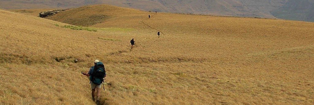
First; of course; we went wrong and up the mountain instead down the valley. Some scrambling was required to get down to the path, no idea where we had gone wrong. After lunch a quick shower of rain overtook us, no problem, putting on our rain gear we pushed on.
 At the place where the path went up the mountain to take us to a view point we rebelled and rather carried on straight along the stream. Some bushwhacking was required to get through. Next problem was to find the huts. Fortunately Allen had the way points in his GPS and we went straight for it.
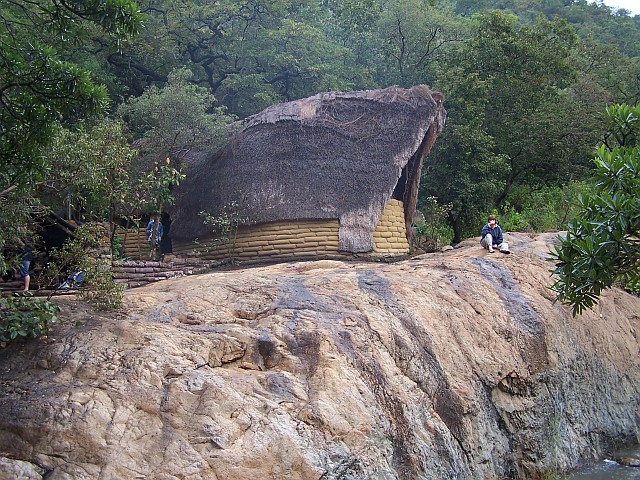
The camp is very basic, two huts with 8 beds. Communal area was very leaky and had no seating places which made the evening a bit uncomfortable since it was still drizzling outside. The evening meal had to be taken standing up. Hot water for the shower was provided by a donkey, going to the shower and the toilet was an adventure in itself. The blanks had rotted through and apparently there was an accident when a hiker broke through, some provisional blanks have now been nailed over this and it is necessary to balance on those when having a shower.
Perhaps a few words generally about the situation there. The hike and the huts were established through funding from the EU. But maintaining the place is not seen by the community as a priority. The hut I slept in was leaking and I had to move my mattress in order to escape the 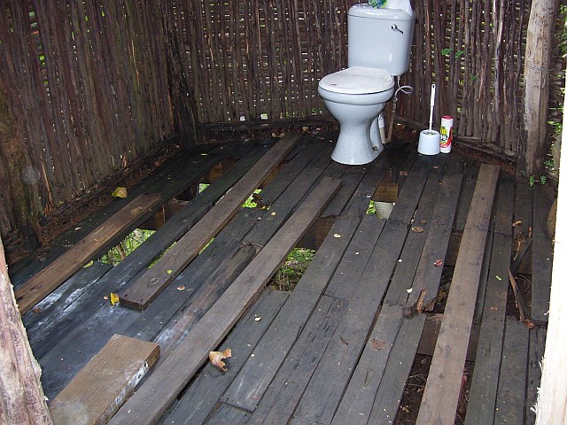 drip. The shower and toillete are a disaster waiting for a serious accident to happen (see picture to the left).
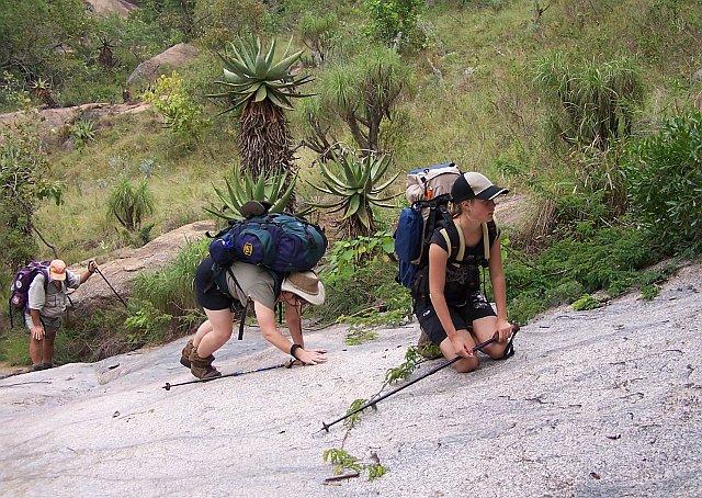
But we survived the night and went off fairly early to do the second day of the hike which took us down the valley and up along the Ngwempisi river. Going was pretty tough because of the ups when we had to navigate over some obstacles along the river. The idea was to have lunch at the river crossing to the hot spring. This had to be canceled because of a high water level in the river. So we pushed on until the up to get to the Khobho Lodge. This up was from 685m to 931m.
 Khobho Lodge is a great hiking hut, its build amongst rocks with various levels and a super view down to the river valley.
The last day was fairly rough, we followed a stream valley all the way up to the B&B. Obstacles were rocks, fallen trees and vegetation in general. But it was fun.
Before getting back over to the border and home we spent the night in the B&B of Mrs Evans.