I am annoyed, I am nearly 71, had a hiking career of about 50 years, and only now have I found this hiking paradise in the sand stone area behind Phuthaditjhaba. To be more precise, north of the Drakensberg range of the Sentinel and Mount aux Sources to the south and Phuthaditjhaba in the north. It has the potential to become one of the premier hiking trails of South Africa.
 We did some of the Maluti cave trail. Bookings are done though Jacana, the trail and huts are a community project.
To get to the first hut requires navigation through the sprawling town of Phuthaditjhaba. For that we had a guide from Free State tourism. It all went well until we got off the paved road and had to climb a hill in muddy conditions. My car didn't make it and after some negotiating the offer from one of the guides to leave the car at his house, which was right there, was accepted. But than even Allen's bakkie had some problems getting up.
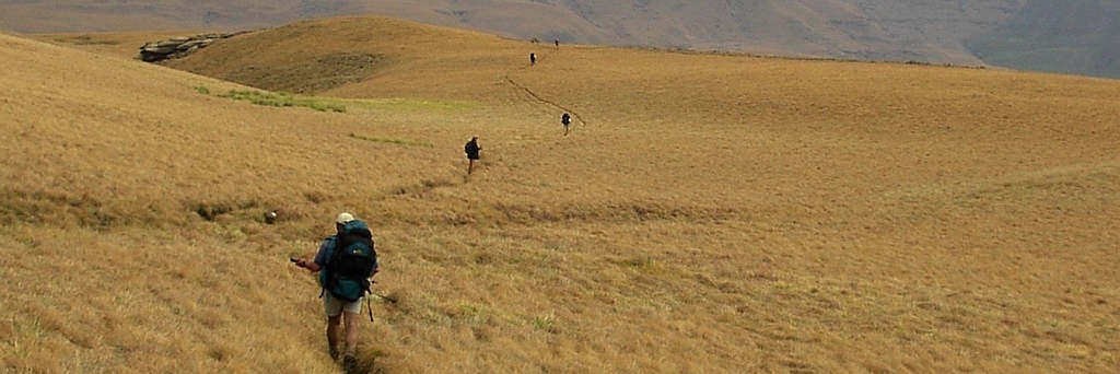
Slept in Tseki hut, fairly comfortably, just that we ran out of water in the evening because 'the community' had forgotten to fill up the tank. And the hiking could start, all in sandstone. We stayed more or less at this altitude of around 2000m, with some minor ups and downs. When we reached the road and we could see the destination we took the easy route following the road until it was time to cut across and go down to Thabaputswa hut.
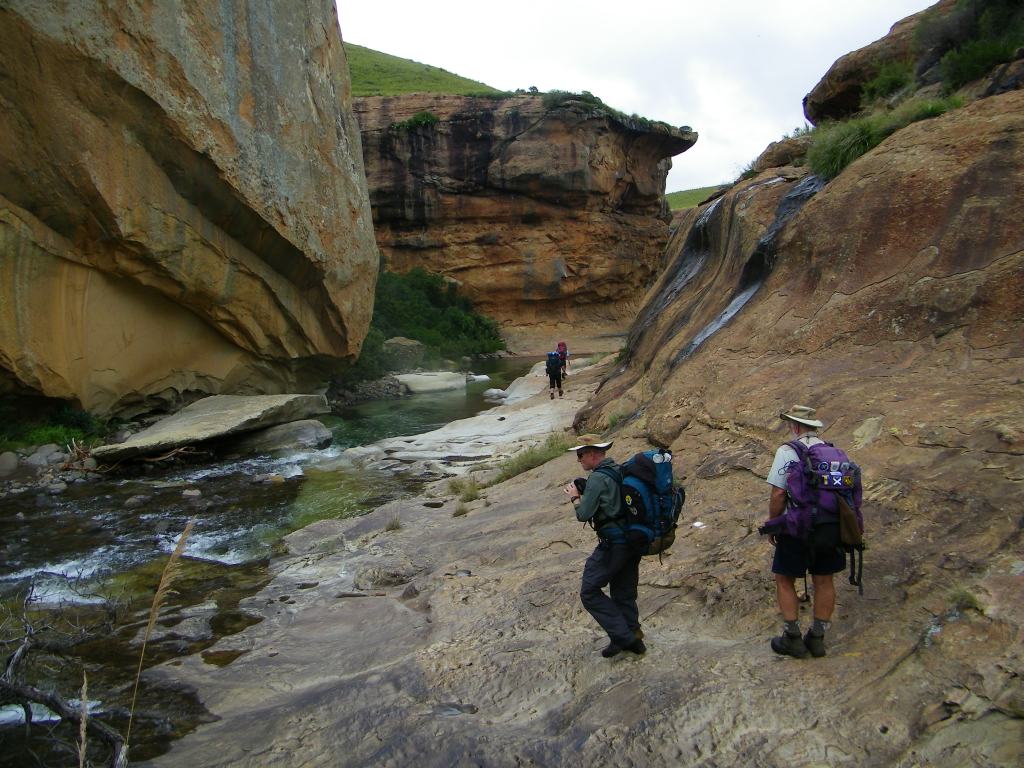
Next day the hike was more spectacular than the previous one, we went down into the gorges, crossing the river numerous times. At one of them my GPS took a dive into the river and was submerged for about 10 seconds. 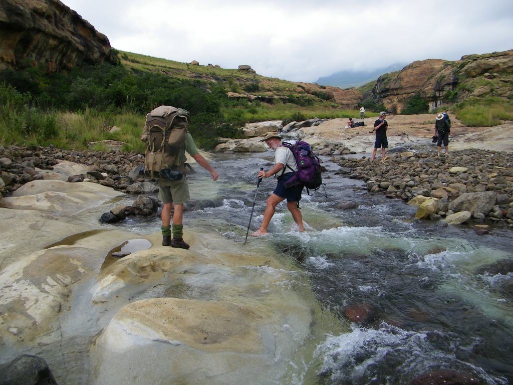 Fortunately it survived, I immediately took out the batteries and didn't switch it on until I got home.
This night we were going to spent in a cave, the hut at this end of the trail had burned down and a cave was used as alternative. I love caves, it brings back memories of nights spent in the high altitude caves of the Drakensberge. For this one we actually didn't know where it was, one of the guides told us at the start of the hike that he would meet us on the trail to show us. He never turned up. But I think we did find it and just didn't like it, too small. So we went to the one shown on the map. That one was big enough, it just had to be cleared a bit. We even managed a 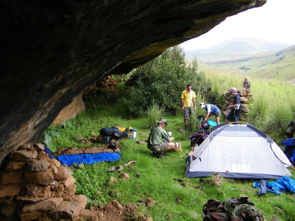 little fire to add atmosphere to the proceedings of the evening. That didn't last long and, I think, by 19h00 the first of us were in bed.
And then the rain came to test our sleeping arrangements. The lip of the cave produced a waterfall, it didn't touch us, only Allen had to make himself a bit smaller to escape the water.
When I woke up through the rain and looked out I noticed the sky being fairly light and still thought it must be morning. Much to my disappointment did Frans announce it is only 01h30. This was going to be a long night.
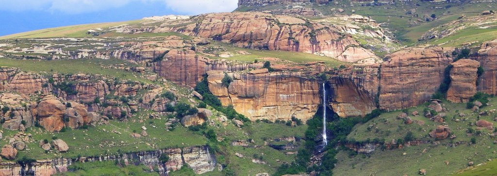
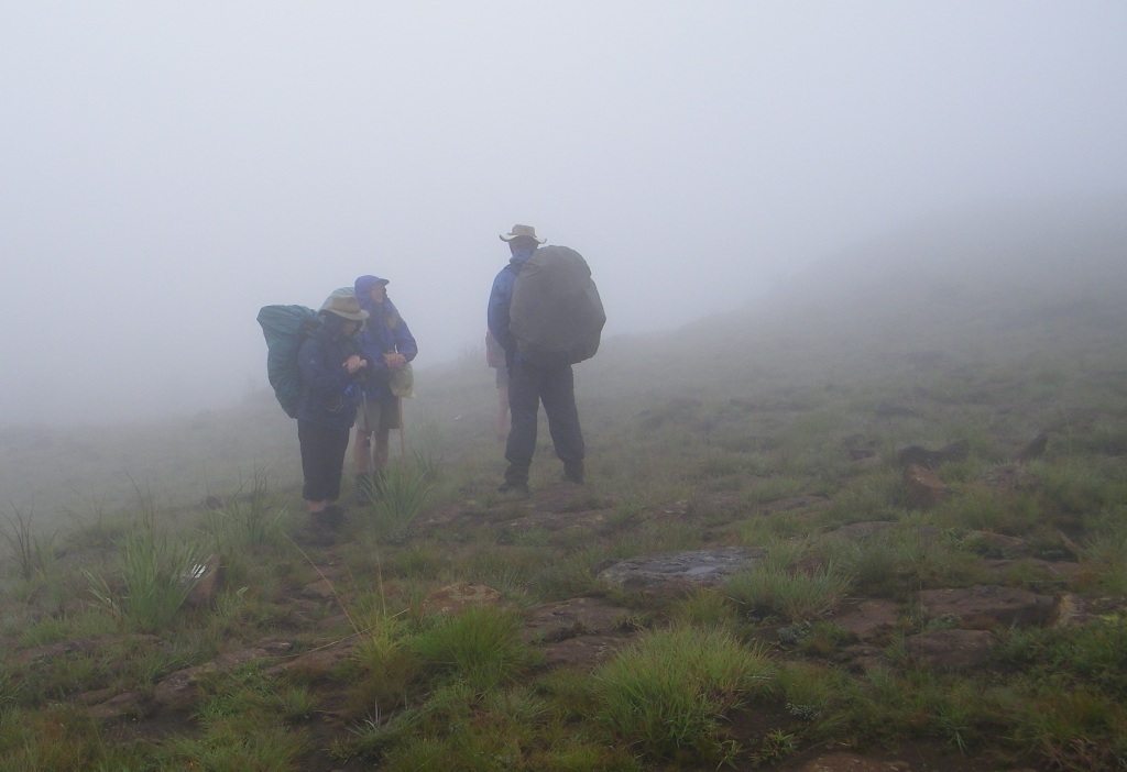
Morning came eventually and we got packed up and off we went. The mist had come in and we lost the path. But not for long, at the dam we found it again. The trail was very easy, sloping slightly down wards for some distance. And when we got to the top of the water fall (the one on the banner picture) it was only mid morning and we thought we would be back at the start hut at lunch time.
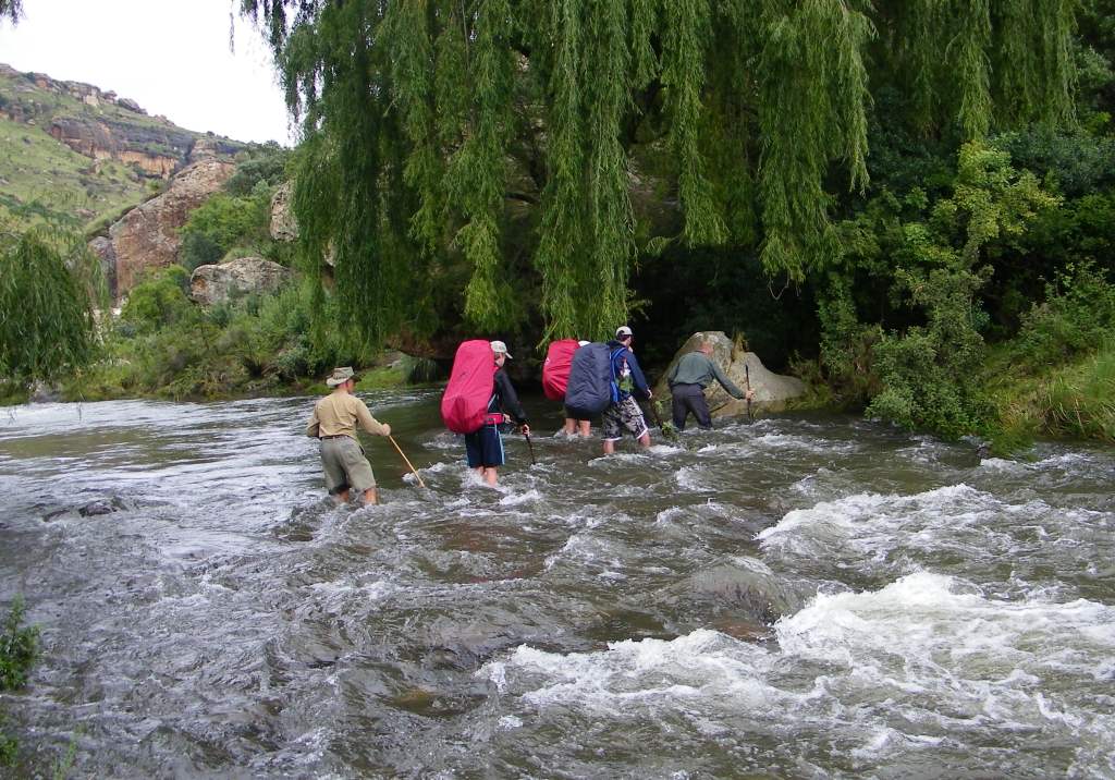
 Not so, in front of us was a wide valley that had to be descended into and a mighty river to be crossed. On the other side was a 200m climb up to the top.
We had lunch on the route and got up by about 14h00. First stop was to check my car, it was still there. And than to the hut, here it was noticed that there was nothing in the hut, no chairs, no beds, no gas, no water (the tank was empty), no pots, no pans and to crown it all no kitchen sink. And also no activity to rectify the situation.
 What was to be done, the easy answer 'let's go home'. So off we went on our way home. Jacana will hear about this when we demand our money back.
But still, despite these little mishaps it was a great hike and a well enjoyed Easter Weekend.